Overview
In addition to physical inspections, modern technologies allow authorities to control fishing activities at sea more effectively than traditional methods.
The EU supports EU countries with funding for the introduction and maintenance of modern control technologies.
Monitoring and inspection of fishery activities
The use of modern technologies, including digital tools, has been increasing in recent years. Some examples include national Electronic Reporting Systems (ERS) and satellite or non-satellite-based tracking of all vessels and the introduction of digital tools in support of traceability to track fish from landing to retail.
Remote Electronic Monitoring (REM) incorporating closed-circuit television (CCTV) systems, sensors and software will become mandatory in order to monitor the compliance with the landing obligation for high risk vessels above 18 metres. It will prevent illegal discards and therefore ensure the accurate documentation of catches.
EFCA has published technical guidelines to facilitate the harmonised adoption of REM controls by EU countries
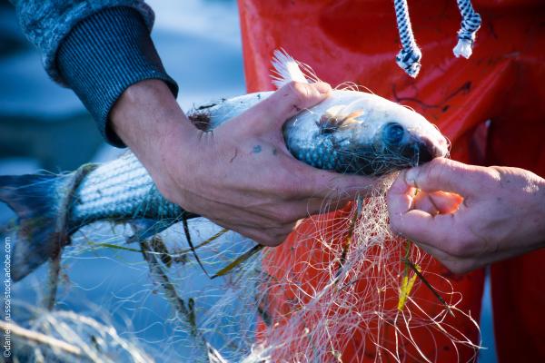
Modern technologies to monitor catches
Electronic Reporting Systems (ERS) is used by fishing vessel masters and national authorities to record, report, process, store and send data on catches, landings, sales and transhipments.
Fishing vessels that are 12 metres or longer must have ERS. Vessels under 15 metres can be exempted if they meet specific conditions until January 2026. Starting in 2028, all vessels, regardless of size, will be required to have ERS.
The key element is the electronic logbook, in which the fishing vessel master records and reports these data electronically rather than in paper format.
After being compiled, this information is sent to national authorities and stored in a secure database. Starting in 2026, masters will also electronically record any by-catches of sensitive species, indicating whether they were released alive, injured, or dead.
In addition to facilitating the work of the master, electronic reporting has the advantage of allowing national authorities to exchange data easily and cross-check it using the United Nations Fisheries Language for Universal eXchange (UN/FLUX). This helps them detect illegal activities that might otherwise go unnoticed.
In 2028, small scale vessels (under 12 metres) will be able to report their catches electronically using mobile apps. These apps allow them to record details such as the species caught, quantities, sizes, and locations where the catch was made. These modern tools are useful for small scale operators because they allow them to promote their catch as 'locally sourced'. At the same time, these tools provide fisheries scientists and managers with crucial data to improve the management of marine resources.
Modern technologies to monitor vessel positions
The EU control system uses satellite-based technologies to track the location, course, and speed of vessels. This helps ensure that rules on where and when vessels can fish are followed.
The Vessel Monitoring System (VMS) is the main system used by fisheries authorities to regularly track and monitor vessels by collecting data on their location, course, and speed. It is mandatory for all EU vessels over 12 metres in length, and the data is shared among EU countries. There are exemptions for vessels under 15 metres until January 2026, and alternative systems including mobile apps using land-based networks will be developed for vessels under 12 metres . By January 2028, all fishing vessels under 12 metres will be equipped and tracked. Some vessels under 9 metres may be exempt until 2030, depending on approval from Member States.
These technologies work alongside patrol vessels, surveillance aircraft, and drones to help identify potential illegal activities.
Documents
Final Report on Catch Quota Management and choke species - 2014
News

Today, the European Fisheries Control Agency (EFCA), in the context of the European Union funded e-FishMed project, launched an exchange programme to enhance cooperation and to promote sharing of expertise and best practices in the fight against Illegal, Unreported and Unregulated (IUU) fishing.
New rules for a reinforced control system enter into force today, Tuesday 9 January 2024.

Among the main measures, the EU and neighbouring countries agreed within the General Fisheries Commission for the Mediterranean (GFCM) to launch new tools to keep track of the activities of all fleets fishing in the Mediterranean and the Black Seas and sharing the various multiannual management