
What is maritime spatial planning?
Maritime spatial planning (MSP), as a process by which the authorities analyse and organise human activities in marine areas to achieve ecological, economic and social objectives, is the main tool to manage the use of our seas and oceans coherently and to ensure that human activities take place in an efficient, safe and sustainable way.
Why do we need maritime spatial planning?
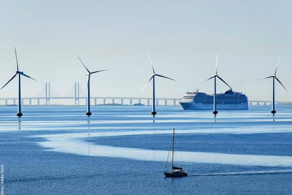
The uncoordinated use of coastal and maritime areas creates competition for maritime space and is an inefficient use of marine resources. With rapidly increasing demand for maritime space for marine protected areas, renewable energy or offshore aquaculture installations, coherent planning of maritime activities at sea is needed.
- It reduces conflicts between sectors and creates synergies between different activities
- It encourages investments by creating predictability, transparency and clearer rules
- It increases cross-border cooperation between EU countries to develop energy grids, shipping lanes, pipelines, submarine cables and other activities, but also to develop coherent networks of protected areas
- It contributes to protection and preservation of the environment through early identification of impact and opportunities for multiple use of space.
- It puts the seas and oceans on the political agenda and helps to raise stakeholder awareness of important maritime issues.
- In addition, there are many indirect benefits including those flowing from systematic data and information collection and stakeholder processes, for instance.
How does the EU promote MSP?
Since the adoption of the MSP Directive in 2014, the Commission took action and set up a number of initiatives to support MSP in the EU, notably a Member States expert group, technical assistance and cross-border projects. This has enabled Member States to make significant progress in areas such as cross-border consultation and cooperation, information and data sharing for and on maritime spatial plans, or increased coherence at sea basin level. These areas will continue to be supported under the 2021-2027 European Maritime, Fisheries and Aquaculture Fund.
How well are Member States implementing the directive?
- The transposition obligations of the Directive are twofold: (1) its transposition into national law and designation of competent authorities by 18 September 2016; (2) the establishment of maritime spatial plans at the latest by 31 March 2021. Regarding the former, the Commission found the transposition into national law to be complete, albeit with some delays.
- With regard to the establishment of maritime spatial plans, progress has been mixed. The report distinguishes four groups of Member States: (1) those whose maritime spatial planning processes either predated the directive or that started very early; (2) a large group that succeeded within the deadline fixed by the directive, or missed it by less than one year. This brings the number of MS with a maritime spatial plan in place to 14 out of 22. (3) Several Member States are advanced in producing draft plans and proceeding towards final adoption, which should happen in the coming months. For the latter, the Commission will closely monitor progress and take action as appropriate. (4) Five Member States did not yet make sufficient progress towards establishing maritime spatial plans in line with the directive’s requirements, so that the Commission sent them letters of formal notice on 2 December 2021.
What are the next steps?
- Member States will continue to implement the MSP Directive by developing and adopting their Maritime spatial plans and reviewing them at least every 10 years. The coming years will see a step change in the role of MSP for the sustainable development of seas, likely accelerated by the implementation of the European Green Deal and related legislation and strategies, like EU Biodiversity Strategy for 2030 or the EU strategy on offshore renewable energy.
- The Commission will continue to support cross-border projects and policy dialogue helping to develop a large and diverse MSP community across the EU. This is a strong asset for future development. Cooperation, in particular at sea basin level, is set to intensify with the transformation of the EU blue economy.
- The Commission will expand the necessary dialogue between the various users of the sea by setting up a Blue Forum for sea users in 2022 and providing continuous support for MSP.
- The Commission will closely follow up on the infringements and monitor those countries that promised to adopt their plans by now (and infringe if necessary)
- The Commission encourages Member States to upload their plans in EMODnet so that the maritime spatial plans can be seen in their entirety in European waters.
What is this progress report for and what does it tell us?
Under Article 14(2) of the MSP Directive, the Commission must submit a report to the European Parliament and the Council outlining progress on the implementation of the Directive by 31 March 2022, and every 4 years after that. This report gives a picture in time - an overview of progress, as required under the Directive, and assesses transposition and conformity. It also looks at developments that have had a bearing on the implementation of the Directive since its adoption in 2014, notably the European Green Deal.
See also
The European Commission has published a report on the implementation of the Maritime Spatial Planning Directive, which sets the obligation for the 22 coastal Member States to establish maritime spatial plans by 31 March 2021 at the latest.
Details
- Publication date
- 3 May 2022
- Author
- Directorate-General for Maritime Affairs and Fisheries